Introductory Memo
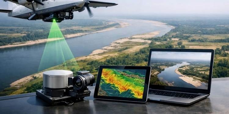
Water resources? Good. Mapping? Done decades ago. This has been the India story so far. Despite being blessed with immense water resources ranging from rivers like Ganga to natural lakes to tanks built by various rulers of ancient times, India lagged in their scientific mapping. The result? Issues in management of water resources. Now, the situation appears to be changing. Advanced geospatial technologies such as LiDAR, drones, photogrammetry, orthorectified imaging, and geotagged videography are being combined to make a good beginning in this regard through survey of Ganga. Apart from creating maps, the project also aims to build a ‘3D digital twin’ of the river and its drainage ecosystem. The project reflects a great shift in the way India understands, maps, and manages its rivers.
No comments yet. Be the first to share your thoughts!